International Academic Exchange under the LOC3G Project Held at TU Clausthal
Focusing on Geohazards in the Nepal Himalaya, intelligent prediction methods and international cooperation. On 24 June 2026, with the support of the EU Horizon Europe Marie Skłodowska-Curie Actions Staff Exchanges project LOC3G (project No. 101129729), the Institute of Subsurface Energy Systems at Clausthal University of Technology (TU Clausthal) hosted an international academic exchange event. Professor Prem Bahadur Thapa from the Department of Geology at Tribhuvan University, Nepal, a former DAAD and Alexander von Humboldt Research Fellow, was invited to TU Clausthal and delivered a lecture entitled “Geohazards in Nepal Himalaya: Insights from Dynamic Mountain System”. The lecture focused on the formation mechanisms of geohazards in the complex geological environment of the Himalaya, methods for risk identification and recent developments in intelligent prediction technologies. It provided students and researchers with an important opportunity to learn about current research progress in geohazards in South Asian mountain regions.
Tribhuvan University is one of the oldest, largest and most influential comprehensive universities in Nepal and plays a central role in the country’s higher education and research system. With approximately 400,000 students, accounting for around 80 percent of Nepal’s higher education student population, the university has a significant impact on education, scientific research and social development in the country. Its research and teaching in geology, engineering geology and geohazards address the needs of the complex geological environment of the Himalaya, natural hazard mitigation, infrastructure development and regional sustainable development. The university has trained a large number of specialists for geohazard risk assessment, mountain engineering safety and disaster risk reduction in Nepal, and has also provided important academic support for the international community to better understand geohazards in the Himalayan region.
LOC3G, short for “Localization in Geophysics, Geohazards and Geoengineering”, is an international cooperation project funded by the Marie Skłodowska-Curie Actions Staff Exchanges programme. The project focuses on localization phenomena and deformation processes in complex geological environments. By integrating multi-scale and multi-physics modelling, experimental research, geological investigation and engineering applications, LOC3G aims to advance methods for geohazard identification, risk assessment and predictive modelling for engineering safety.
The project brings together universities, research institutions and engineering partners from Europe and Asia. Through researcher exchanges, joint research, academic training, doctoral schools and field investigations, LOC3G promotes collaboration among different disciplines, regions and research traditions. As an important participating institution, TU Clausthal has been actively involved in LOC3G-related research and has continued to strengthen cooperation with international partners in underground engineering safety, geohazard prevention and mitigation, energy geology and coupled multi-field numerical modelling. Professor Thapa’s visit was not only a specialist lecture for students and researchers, but also an important part of the continuing exchange between European and South Asian partners within the LOC3G framework. It further strengthened cooperation in geohazard research, engineering geological investigation, numerical modelling methods, artificial intelligence applications and the training of early-career researchers.
Professor Zhengmeng Hou chaired the event and reviewed the cooperation with Nepal
The academic exchange was chaired by Professor Zhengmeng Hou from the Institute of Subsurface Energy Systems at TU Clausthal, who warmly welcomed Professor Thapa. Professor Hou has long been engaged in research on subsurface energy development, geotechnical engineering, rock mechanics, coupled multi-field processes, underground energy storage, geothermal energy development and geological CO₂ storage. He has extensive research experience and a broad international cooperation network in subsurface energy systems and engineering geology.
In recent years, Professor Hou has actively promoted academic links between TU Clausthal and international partners within the LOC3G project. He has also visited Nepal for academic exchange, scientific cooperation and engineering geological field investigations in the Himalayan region. These visits have deepened the shared understanding of the complex geological environment, engineering geological conditions and geohazard challenges in the Nepal Himalaya, and have laid a solid foundation for future joint research, student exchanges and project cooperation.
Professor Hou noted during the event that geohazard prevention, underground engineering safety and energy geology all require interdisciplinary perspectives and international cooperation. Against the background of frequent mountain geohazards, increasing extreme weather events and higher safety requirements for infrastructure development, it is important to strengthen the integration of geology, geotechnical engineering, numerical modelling, artificial intelligence and disaster management. Professor Thapa’s visit created a new opportunity for both sides to deepen cooperation, expand research networks and further support the training of young researchers within the LOC3G framework.
Focusing on the research frontier of geohazards in the Himalaya
In his lecture, Professor Thapa drew on his long-term research and field investigation experience in the Nepal Himalaya to introduce the complex tectonic setting, characteristics of dynamic mountain systems and formation mechanisms of typical geohazards in the region. The Nepal Himalaya is located in one of the most active orogenic belts in the world. It is affected by plate collision, tectonic uplift, intense rainfall, river erosion, seismic activity and human engineering activities. As a result, the region has long been exposed to risks such as landslides, rockfalls, debris flows, river blockage and cascading mountain hazards. Professor Thapa emphasized that geohazards in the Himalayan region show strong spatial variability and process complexity. Their formation and evolution are controlled by multiple factors, including topography, lithological assemblages, fault structures, rainfall patterns, land use and road construction. Scientific identification and risk assessment in such an environment therefore require the integration of traditional geological investigation and engineering geological analysis with remote sensing, GIS, numerical modelling and data-driven methods.
Focusing on risk identification and prediction for mountain geohazards, the lecture presented a complete research workflow covering landslide inventory database construction, field investigation, extraction of terrain factors, preparation of geological maps, multi-model analysis and risk mapping. This workflow reflects a systematic research approach, moving from phenomenon identification and mechanism analysis to model prediction and risk management. In terms of methods, Professor Thapa highlighted the integrated application of GIS spatial analysis, three-dimensional geological modelling, finite element numerical modelling and machine learning in landslide research. He explained how geohazard databases can be constructed using remote sensing images, topographic maps, geological maps, field survey data and landslide inventory data, and introduced the extraction and processing of key conditioning factors such as slope angle, aspect, elevation, curvature, land use, engineering geological conditions, distance to roads, distance to rivers, topographic wetness index, vegetation index and stream power index. By using automated tools such as ArcGIS Model Builder, complex and repetitive spatial data processing steps can be transformed into reusable workflows, improving the efficiency of multi-region, multi-scenario and multi-factor analyses. This also shows that data collection, database construction and feature engineering are critical foundations for reliable intelligent prediction models in geohazard research.
In the field of numerical modelling, the lecture introduced the application of the limit equilibrium method (LEM), finite element method (FEM) and particle finite element method (PFEM) in slope stability analysis and landslide movement simulation. By simulating factors of safety and landslide processes under different slope heights, moisture conditions and material parameters, these models can reveal mechanical behaviour before and after slope failure, velocity evolution and deposition processes, thereby providing support for understanding the physical mechanisms of landslides. In the field of machine learning, Professor Thapa presented the use of logistic regression, random forest, support vector machine and artificial neural network models for landslide susceptibility assessment, and compared model performance using ROC curves, AUC indicators and cross-validation. The lecture also introduced explainable artificial intelligence (XAI), using SHAP and related tools to analyse the contributions of engineering geological conditions, topographic wetness index, slope, road distance, river erosion and land use to model outputs. This helps improve the transparency and engineering credibility of machine learning results.
Beyond modelling methods, Professor Thapa also shared Nepal’s practical experience in geohazard monitoring, early warning and community-based disaster risk reduction. He introduced the development of landslide early warning systems (EWS) for mountain communities, including disaster information collection, risk-level assessment, mobile information dissemination and community response mechanisms. The lecture emphasized that geohazard research should not remain limited to risk maps or model performance indicators. For mountain communities, local governments and infrastructure managers, research outcomes are truly valuable only when they can be transformed into understandable, communicable and actionable warning information and management measures. Therefore, connecting scientific models with operational early warning systems, community participation mechanisms and disaster management processes is an important step for geohazard research to move towards practical application.
Active discussion promoted interdisciplinary thinking and exchange among young researchers
During the discussion session, participants exchanged views on the generalization ability of machine learning models, the role of data quality and feature engineering in intelligent prediction, the integration of traditional numerical modelling with data-driven methods, model interpretability and the feasibility of applying geohazard early warning systems in different regions. Drawing on his experience in geotechnical engineering, subsurface energy systems, coupled multi-field processes and international cooperation, Professor Zhengmeng Hou pointed out that the formation and evolution of landslides are controlled by multiple interacting factors. They should not be understood only from surface factors such as slope angle, topography, rainfall and land use. Regional structural geology, stratigraphic architecture, lithological assemblages, fault development, groundwater activity and engineering disturbance should also be fully considered as deeper and long-term controlling factors. In highly active mountain regions such as the Himalaya, where tectonic activity is strong, relief is steep and extreme rainfall events are frequent, structural geological conditions often determine the basic stability and potential failure modes of slopes, while climate change and extreme weather events may further trigger or amplify the risks of landslides and debris flows. Therefore, landslide risk identification, intelligent prediction and early warning system development should further strengthen the integrated analysis of structural geological background, engineering geological conditions, climate change impacts and hydrogeological processes.
With regard to monitoring and early warning, Professor Hou further suggested that future work could build on traditional field investigation and ground monitoring by integrating unmanned aerial vehicles, satellite remote sensing, fibre-optic monitoring, ground-based sensors and multi-source environmental monitoring technologies. Such an approach could support the development of an air–space–ground integrated, continuous and multi-scale monitoring system for mountain geohazards. For example, unmanned aerial vehicles can be used for high-resolution terrain mapping, rapid post-disaster investigation and detailed identification of local hazardous areas. Satellite remote sensing can support long-term and large-scale monitoring of surface deformation, geomorphological change, vegetation cover change and potential risk zones. Fibre-optic monitoring can provide information on displacement, deformation and stress changes inside slopes and at key locations. Ground-based sensors and in-situ monitoring systems can continuously record rainfall, groundwater flow velocity, pore-water pressure, temperature changes and other hydrogeological parameters. By combining aerial remote sensing, satellite observations, in-situ monitoring and subsurface monitoring data, it becomes possible to more comprehensively describe the evolution of a slope from slow deformation to instability and failure, and to provide more reliable data support for landslide risk identification, process analysis and warning decisions.
Regarding prediction methods, Professor Hou suggested that future research could further integrate multi-source monitoring data, structural geological models, engineering geological parameters, climate and extreme weather information, and finite element numerical modelling into a unified analytical framework. Such an approach would help build integrated prediction models with stronger physical foundations and greater engineering interpretability. By combining structural geological conditions, groundwater variations, heavy rainfall processes, slope displacement and deformation, stress evolution and historical landslide inventories, it would not only improve the predictive accuracy of machine learning models, but also help prevent models from remaining at the level of purely statistical correlations. In complex mountain geohazard research, data-driven methods should complement mechanism-based understanding, numerical modelling and field monitoring, thereby moving prediction models beyond the simple output of risk levels towards understanding hazard evolution processes, determining warning thresholds and supporting engineering prevention and control decisions.
Professor Hou also noted that, in the context of global climate change and carbon neutrality goals, geohazard research is becoming more closely connected with subsurface energy system safety, geothermal resource development, geological CO₂ storage and the long-term stability of underground engineering. On the one hand, climate change may intensify heavy rainfall, extreme weather events and changes in hydrogeological conditions, thereby increasing the risks of landslides, debris flows and slope instability in mountainous areas. On the other hand, engineering activities such as subsurface energy development, geothermal utilization and geological CO₂ storage also require a thorough understanding of underground rock structures, in-situ stress conditions, seepage processes and long-term stability. Therefore, integrating geohazard risk assessment, subsurface energy system safety evaluation, intelligent monitoring technologies and numerical modelling methods can not only enhance mountain hazard early warning capacity, but also provide important support for energy development and engineering safety in complex geological environments.
Participants also discussed the practical value of machine learning methods in engineering geology. On the one hand, machine learning models can rapidly identify potential risk zones over large areas and provide a flexible framework for integrating remote sensing, terrain, geological, hydrological and land-use data. On the other hand, the predictive performance of these models still depends strongly on the quality of landslide inventories, understanding of geological background, spatial sampling strategies and the construction of environmental factors. They cannot function effectively without solid geological investigation, monitoring data and engineering experience. The discussion showed that geohazard research needs to build a closer connection between data-driven methods and mechanism-based understanding. It should integrate machine learning, explainable artificial intelligence, finite element modelling, structural geological analysis, air–space–ground integrated monitoring and engineering practice, in order to move from model performance evaluation towards process interpretation, risk management and practical application.
The lecture covered geological investigation, GIS analysis, numerical modelling, machine learning, explainable artificial intelligence and disaster early warning practice. It provided valuable opportunities for early-career researchers from different disciplinary backgrounds to exchange ideas. Through the lecture and discussion, participants deepened their understanding of complex geohazard problems in the Himalaya and gained further insight into the combined roles of structural geological conditions, extreme weather events, groundwater activity, multi-source monitoring data and intelligent algorithms in the study of complex geological systems.
Looking ahead: strengthening international cooperation and training young researchers
After the lecture, Professor Zhengmeng Hou expressed his appreciation on behalf of the LOC3G project team for Professor Thapa’s inspiring presentation and in-depth exchange. Accompanied by Professor Hou and members of the research team, Professor Thapa then visited the surroundings of the Institute of Subsurface Energy Systems and learned more about the institute’s research activities in subsurface energy development, geothermal utilization, geological CO₂ storage and geotechnical experimental research. The two sides further discussed their research foundations, potential joint research projects, student exchanges and long-term cooperation mechanisms.
This international academic exchange not only deepened participants’ understanding of geohazard characteristics and research frontiers in the Nepal Himalaya, but also further expanded the academic links between TU Clausthal and Tribhuvan University. The event fully demonstrated the important role of the LOC3G project in promoting researcher mobility, interdisciplinary integration, international cooperation networks and the training of young researchers. In the future, both sides will continue to rely on international cooperation platforms such as LOC3G to carry out deeper and broader collaboration in geohazard risk assessment, subsurface energy system safety, intelligent prediction methods, explainable artificial intelligence, numerical modelling and early-career researcher training, thereby contributing scientific expertise to engineering safety and disaster risk reduction in complex geological environments.
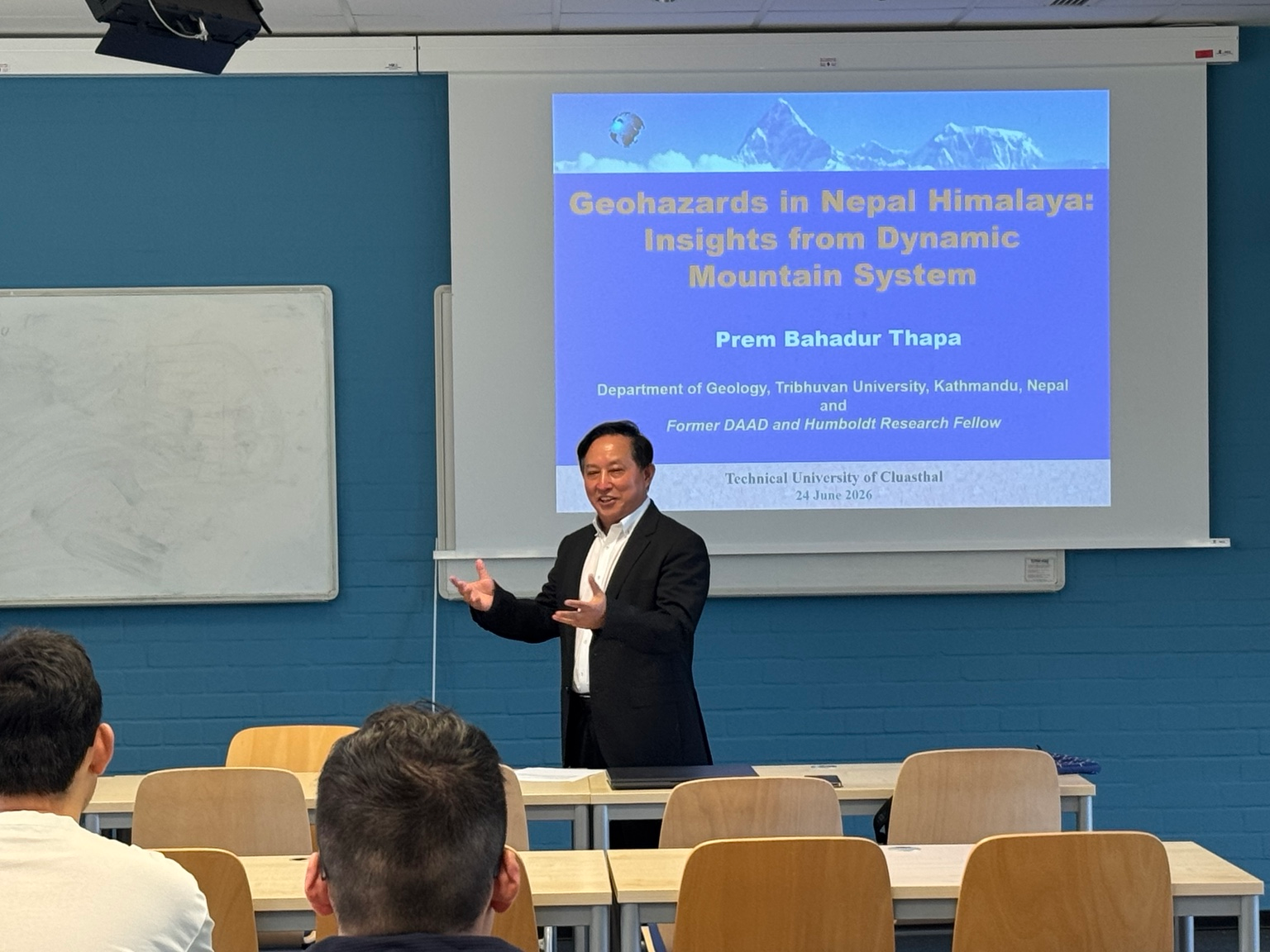
Figure 1. International academic exchange under the LOC3G project. Professor Zhengmeng Hou chaired the event and introduced the visiting scholar
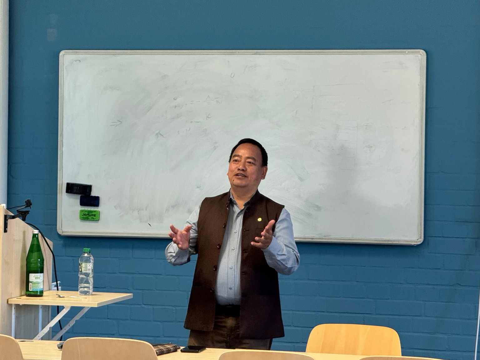
Figure 2. Professor Thapa explaining geohazard cases from the Nepal Himalaya.
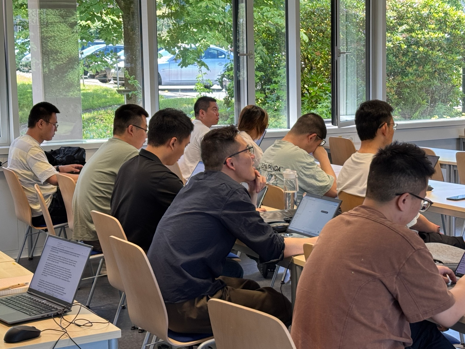
Figure 3. Participants listening to the lecture and discussing intelligent geohazard prediction and risk assessment.
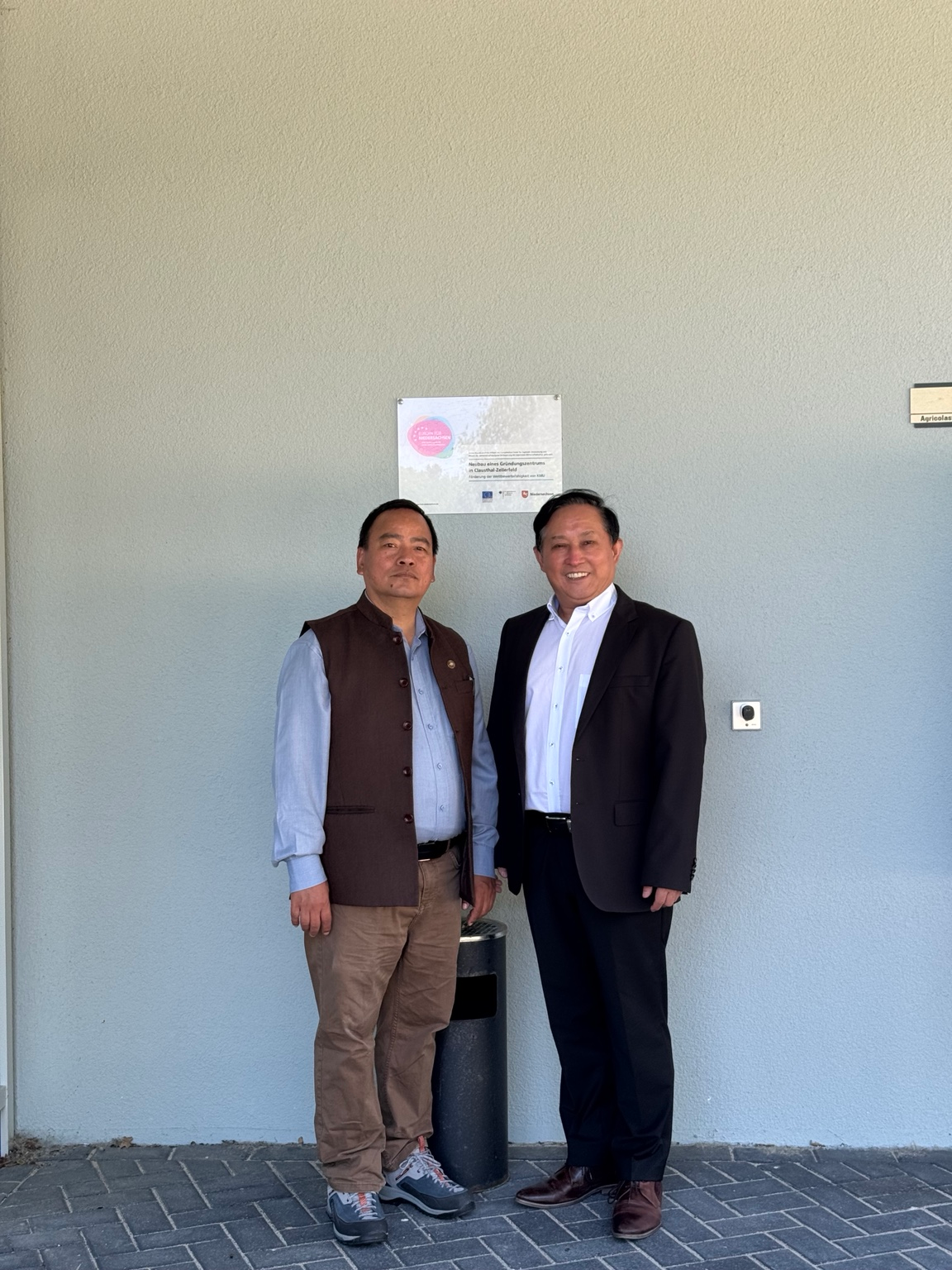

Figure 4. Professor Zhengmeng Hou and Professor Thapa during the exchange visit near the institute.
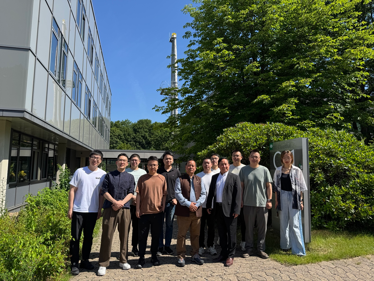
Figure 5. Group photo outside the Institute of Subsurface Energy Systems.